
One Day at the Grand Canyon
Sedona is a fabulous place to visit for its own natural beauty and outdoor activities. It’s also a great place to use as a base for a day trip to the Grand Canyon. Sedona is located about a 2 ½ hour drive from either the West Rim or the South Rim of the Grand Canyon. Each of the Rim areas has a very different feel from each other- the West Rim is a desert like landscape while the South Rim emerges from woods. Neither destination disappoints visitors. There is nothing as awe inspiring and mesmerizing as seeing the Grand Canyon for the first time or the umpteenth time!
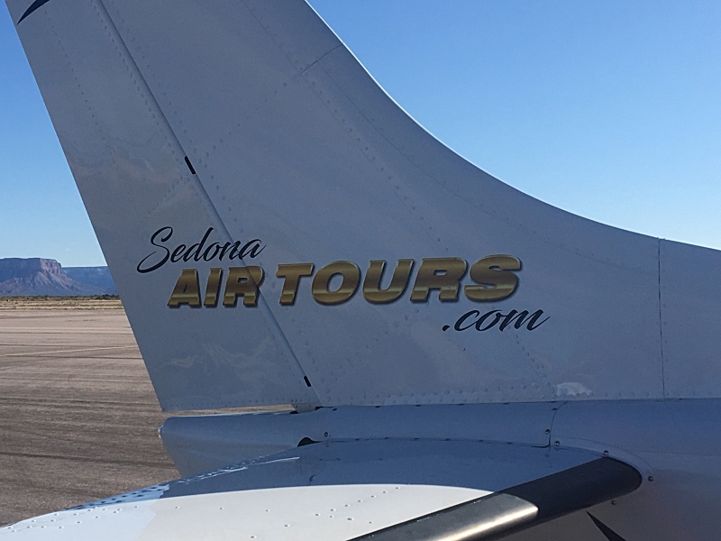
Our plane!
On this trip, we decided to visit the West Rim which is a little bit farther from Sedona than the South Rim. For us, getting there was an exciting adventure. For the first leg of our trip, we drove 20 minutes from Sedona to Cottonwood, Arizona. We arrived at the small Cottonwood airport where we met Caleb, our pilot from Sedona Air. I was a little uneasy about flying in a small, 7 passenger, prop plane. But Caleb instantly put me at ease. We were all excited for the hour-long flight. After a quick flight check, we were up in the air soaring above the bright red rocks of Sedona.

Prescott National Forest
Our flight path took us over the red rocks and parts of Prescott National Forest. The Ponderosa Pines were everywhere. Every now and then we would see a truck driving but the forest was virtual empty of people. Caleb pointed out that we were following the route of the famous Route 66. One of the original highways of the U.S. highway system, the road was built in November 1926. It was the main thoroughfare between Chicago, ILL and Santa Monica, CA earning itself several nicknames including the Main Street of America, the Mother Road, and the Will Rodgers Highway. It actually passed through 8 states. Due to westward expansion, many towns popped up along the highway and prospered. In the 1960s with the advent of major interstate highways, Route 66 was decertified as a highway and labeled “Historic Route 66.” By then many of the once booming towns became ghost towns.

Ponderosa Pines

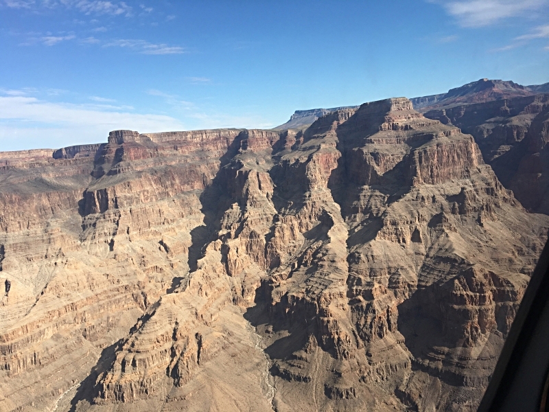
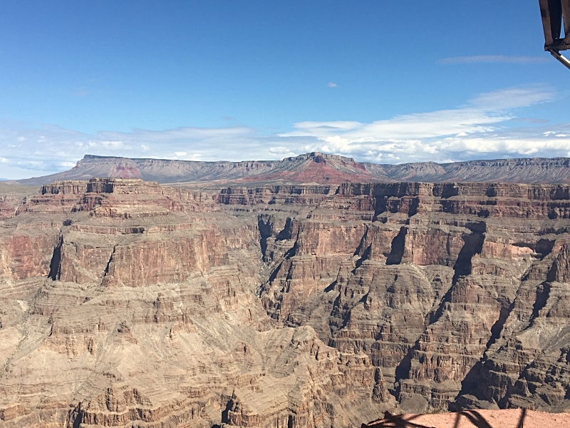
Our first glimpse of the Grand Canyon from plane
As we got closer to the West Rim, the landscape changed dramatically. No longer did we see the green of the Ponderosas. Now our view looked more like the desert filled with smaller canyons. The West rim is located closer to Nevada and the Mojave Desert thus has more of this desert feel. It is hard to express in words the sight of the Grand Canyon as it comes into view. The canyons, the colors, and the overall view are just astounding. It’s amazing to spend a whole day there and watch how the sun affects the different layers of the canyon. The airport at the West Rim is really cool too. We landed right on the edge of the canyon. We were very ready to explore.

Our Helicopter!
The land of the West Rim is owned by the Hualapai Indian Tribe. Years ago, the tribe owned 5 million acres of land. Today their reservation, which was founded in 1883, consists of 1 million acres of their ancestral land from the south part of the Colorado Plateau to the Grand Wash Cliffs. The northern boundary of their land is the Grand Canyon and Colorado River. They control the entire area of the South Rim where they have created three points of interest. Everything begins at the airport terminal. Our first stop was a helicopter ride down into the canyon. The four of us boarded our private helicopter for the 5 minutes’ ride down toward the Colorado. It’s a breathtaking view as you cross over the rim and begin the descent staring at the various rock layers. We landed right on the edge of the river where our guide was waiting on a pontoon boat.
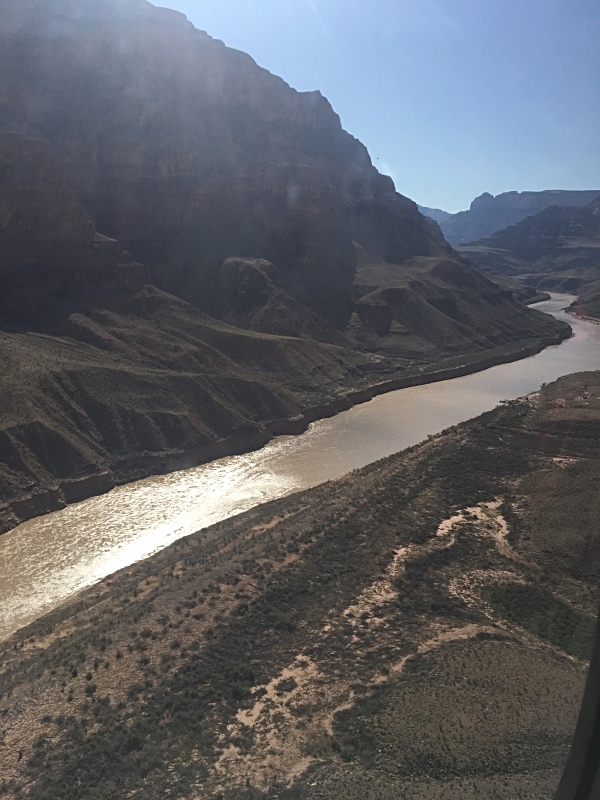


View up from our boat
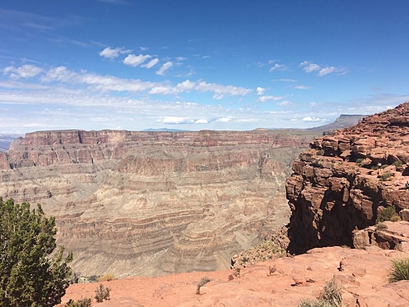
After boarding the boat, our guide drove us up river a bit. It was really cool to see the opposite view! Looking up from the Colorado truly gives you a sense of how impressive the Grand Canyon is. The towering cliffs and different colorful layers of the rock from different time periods are awesome. The Colorado River was a bit of a murky brown color due to the heavy rains that had occurred during August. Normally the river is a greenish blue. As a family of boaters, we found the boat ride itself a bit anti-climactic but the views surrounding us made up for that. After the boat ride, we climbed back into the helicopter and headed back up to the rim.

Pontoons aplenty!

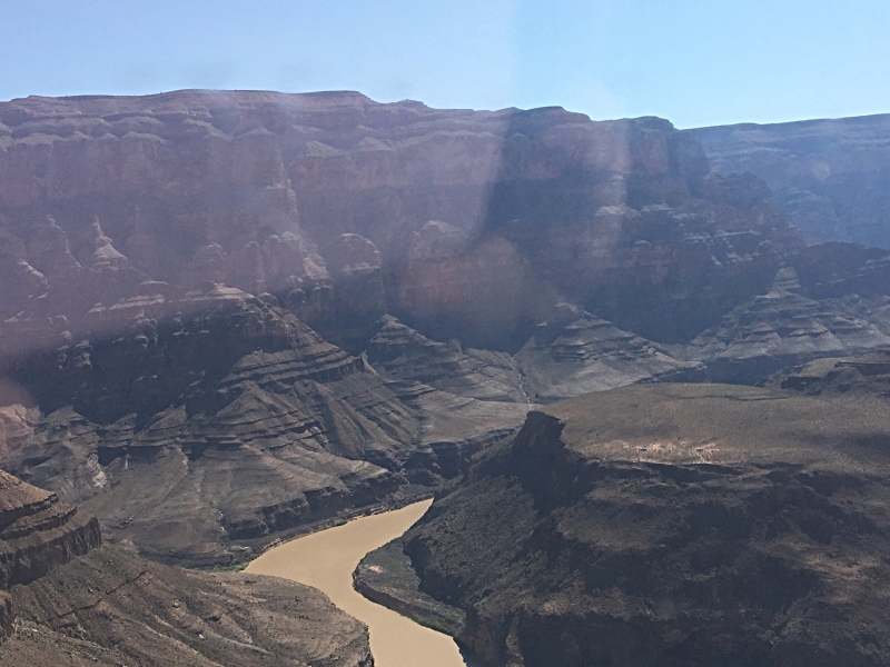
View west from boat
The next part of our adventure was an exploration of the 3 points of interest on the Hualapai land: Hualapai Ranch, the Skywalk at Eagle Point, and Guano Point. The Hualapai Tribe controls this area and provides a convenient bus to connect all three. This is the only way to access this area. The first stop (which we actually decided to skip) was the Hualapai Ranch, a re-creation of an old Western town with games, stage coach rides, shops and entertainment. But we were here for the Canyon! The bus continued on bringing us to Eagle Point.

Eagle Point View
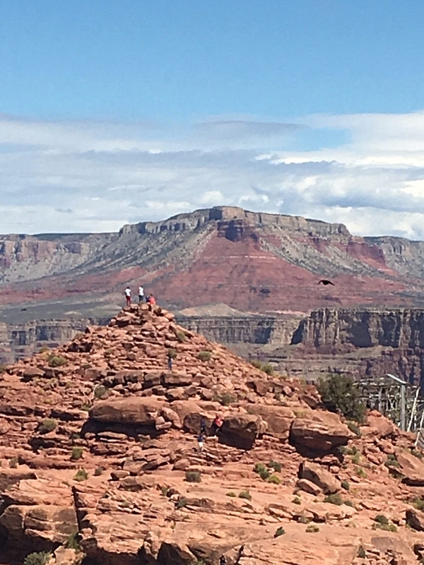
Eagle Point was named for a natural rock formation that looks like an eagle. There are several different things to see here. A re-creation of an authentic Native American village provides an insight into how the Hualapai, Hopi, Navajo, and Plains tribes lived. An amphitheater presents Native American dances twice a day. There is also a restaurant, SA’ NYU WA, which presents a fusion of Southwest, Asian and traditional tribal dishes. But the star of Eagle Point is the view and the Skywalk. Approaching the rim is a crazy experience. I was amazed how there is no barrier to shield a visitor from dangling their legs over the side. It’s a bit scary getting too close to the edge. The view, however, was spectacular. The Skywalk is built right on the edge of the rim extending 70 feet out to maximize these views. It sits 4000 feet above the Grand Canyon floor. It is an incredible engineering feat: 10 feet wide, horseshoe shaped, made of clear glass. The glass allows you to see straight down to the bottom as you walk around it. If you are nervous about being on the bridge- not necessary! It was built to hold the weight of seventy 747 passenger jets!

View of Skywalk from our plane

Standing at edge of Eagle Point
From Eagle Point, we boarded the bus which brought us to Guano Point. Guano is the word for bat excrement. It is used to make very nutrient rich fertilizer. In the 1930s, boaters on the Colorado discovered a cave in the Canyon filled with guano. For 20 years, they tried to figure out how to mine it from such a difficult location. The U.S. Guano Corporation purchased the cave property because they believed there was about 100,000 tons of guano in the cave. They proceeded to build a tram on the rim which cost $3.5 million to build. The tram was actually built on the Hualapai land which the tribe leased to the corporation. The tram traveled over 8,800 feet across the Canyon above the river to the mine and descended 2,500 vertical feet. By 1959, the company’s resources were all gone; they had only found about 1,100 tons of guano. Around the same time, an air force jet on a practice run crashed into the cable of the tram. This ended the mine. Today, the remains of the tram sit at the end of Guano Point.

Guano Point restaurant
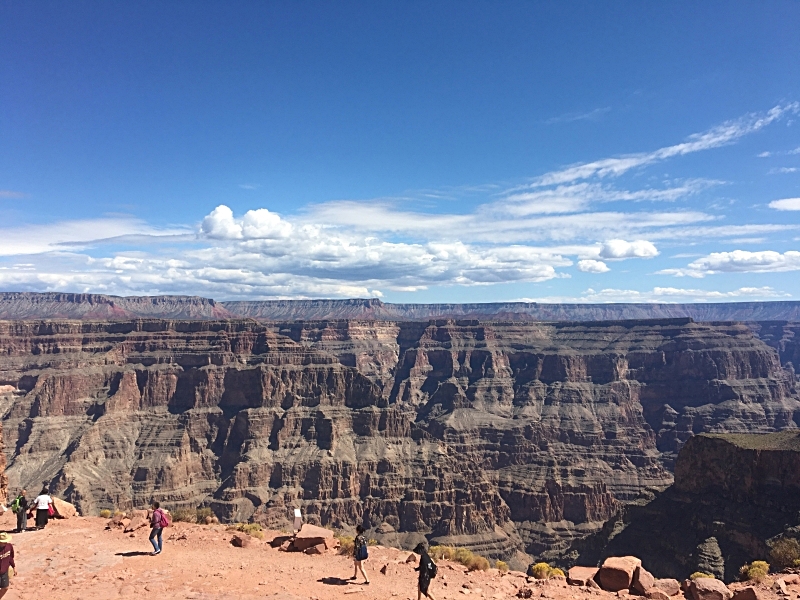
Before heading out to explore, we stopped in the small deli like restaurant were the Hualapai serve a BBQ meal. We were skeptical at first but the food was delicious. After eating we climbed the “highpoint hike,” which brought us to the top of a rock hill. From the top, we had 360 degree unparalled views of the canyon. Gorgeous! We could see forever. As we explored this area, we were again amazed at the lack of railings or barriers by the edge of the rim! We worked our way to the end of the point checking out the tram remains. Each spot we stopped at on Guano Point provided us with more incredible views of the Canyon.
After Guano Point, we returned to the airport to meet Caleb for our flight back to Cottonwood. Flight time back was about an hour. We were all tired and welcomed the hour-long rest. We had left out hotel around 7:30 am and returned by 2:00 pm. We were so thrilled with our Grand Canyon adventure. The Grand Canyon is truly an awe-inspiring sight and a natural wonder of the world. I am always so amazed by how the view changes from each different vantage; how the colors change depending on the time of day; and how overwhelming and beautiful it is to just stare at this natural wonder. The Grand Canyon should be on everyone’s must see list!
Quick Points